Showing posts with label Croton Aqueduct. Show all posts

Sunday, February 26, 2012

Fox Conner

I dote on Ralph E. Luker's postings to the history blog called Cliopatria and while visiting there I happened upon a link to a book review by Jonathan Yardley. Yardley is always worth reading and this piece is as good as most. It's his review of Jean Edward Smith's new book on Dwight Eisenhower and in it he happens to mention the military officers who mentored Eisenhower during the two decades following his 1915 graduation from West Point. The name of one of these men caught my eye because it's the name of an uncle of my brother's wife.

I remember the uncle as owner of a smallish manufacturing plant which, from the 1930s through the '60s, produced a humane animal trap called Havahart™. I remembered two other facts: (1) the traps were invented by an eccentric German who sold the patent to the uncle sometime before WWII and (2) after the outbreak of that war, the uncle switched production from traps to a military item: liners for the fuel tanks of armored vehicles.

A bit of research shows both these facts to be true.

I also have a vague memory of the old brick factory where the traps and liners were made, located in Ossining right next door to the village in which I had been raised. Though I'm uncertain I actually saw it, there's no doubt about the existence of the place. Having begun as a plant for making a patent medicine called Brandreth's Pills and having been turned to other uses in the next 150 years or so, it now stands unkempt and empty.

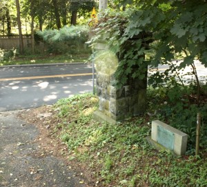
This image shows the office building with the factory structures behind.

{The photo was taken from the west, or river, side of the property; caption: Buildings of the former Brandreth Pill Factory complex in Ossining, NY, USA source: wikipedia}

This is what the main factory buildings look like.

{Taken from the north, this shows part of the office and two of the Brandreth factory buildings; source: aolcdn.com}[1]

This river-side view of the property comes from a certificate awarding the right to sell Brandreth Pills in Italy. It is dated 1863. The base of the copula still exists but there are only a few indistinct remains of the Greek-revival portico seen up the hill at right. The buildings are located on a cove of the Hudson River with the New York Central Railroad (indicated by smoke from a locomotive chimney) and Haverstraw Bay (indicated by distant hills) shown on the horizon. There is some artistic license taken. The cove was somewhat smaller than shown and the buildings are shown facing the wrong direction. They faced the river to the west, not, as shown, south toward the hamlets of Sing Sing and Sparta. The building at center is the original factory; at right is an office, and the hill-side structures are a "summer house" (with copula) and residence (with columned portico).[2]

{Detail from a Brandreth certificate of agency of 1863; source: Westchester Archives}

This detail from an 1868 property atlas shows the cove and orientation of the buildings. Click to view full size. Most of the factory structures are shown top left. There is one by the train tracks at river side and the remaining Brandreth buildings are office, store house, stable and residences.[3]

{Detail from Singsing, Town of Ossining, Westchester Co., N.Y. (Atlas of New York and vicinity by F.W. Beers published by Beers, Ellis & Soule, New York, 1868); source: David Rumsey Historical Map Collection}

This satellite image shows the area as it is now. The two residences that I've marked are both modern buildings built roughly on the location of the original ones. The building marked "Office" dates from 1838 and is the first factory building on the site. It is labeled "Pill Fact." on the 1863 atlas. The buildings I call "Pill and Plaster Factory Bldgs" were built in the next couple of decades and are called "Drug Mill & Plaster Manufactury" on the atlas.[4]

{source: Google}

This photo shows the property from out on the river to the west. The "Pill and Plaster Factory Bldgs" are directly behind the white structure at left. The "office" is along the shore at right. Other structures are hidden by the trees. The church seen mid-right is the one where the factory owners and their families attended services.

{The Brandreth property seen from the river; source: hiddencove.us}

The uncle's name was Fox Conner as was the name of Eisenhower's mentor, and the one was son to the other — Fox Brandreth Conner, son of Fox Conner. Fox Conner was General Pershing's chief of staff. There's much to be read about him, and if you're interested, the wikipedia article on him is a good place to start. There's also a book on him, Grey Eminence: Fox Conner and the Art of Mentorship by Edward Cox (New Forums Press, 2010).

The factory that Fox Brandreth Conner ran has an interesting history.

The first factory building was put up in 1836 on property purchased from Oliver Cromwell Field, a direct descendant of the Lord Protector.[5] Field's house, on a promontory called Spring Hill, became the residence of the new owner, Benjamin Brandreth. You can read a concise history of Benjamin Brandreth and his family here (pdf). His grandfather invented Brandreth's Pills in Leeds, England, and Benjamin brought the business first to New York City and then to the land he'd bought from Field. The pills were a powerful vegetable-based purgative. A great-great grandfather of Fox Brandreth Conner, Benjamin was one of America's first advertising geniuses. His entrepreneurial ability made them just about universally known in their time. An astute businessman, he succeeded in acquiring and preserving a considerable fortune. In his book, Humbugs of the World P.T. Barnum describes Brandreth's early success:
"Great and reasonable as might have been the faith of Dr. Brandreth in the efficacy of his pills, his faith in the potency of advertising them was equally strong. ... Column upon column of advertisements appeared in the newspapers, in the shape of learned and scientific pathological dissertations, the very reading of which would tempt a poor mortal to rush for a box of Brandreth's Pills; so evident was it (according to the advertisement) that nobody ever had or ever would have "pure blood," until from one to a dozen boxes of the pills had been taken as "purifiers." The ingenuity displayed in concocting these advertisements was superb, and was probably hardly equaled by that required to concoct the pills.

No pain, ache, twinge, or other sensation, good, bad, or indifferent, ever experienced by a member of the human family, but was a most irrefragable evidence of the impurity of the blood; and it would have been blasphemy to have denied the "self-evident" theory, that " all diseases arise from impurity or imperfect circulation of the' blood, and that by purgation with Brandreth's Pills all disease may be cured." The doctor continued to let his advertising keep pace with his patronage; and he was finally, in the year 1836, compelled to remove his manufactory to Sing Sing, where such perfectly incredible quantities of Brandreth's Pills have been manufactured and sold that it would hardly be safe to give the statistics. Suffice it to say, that the only "humbug" which I suspect in connection with the pills was, the very harmless and unobjectionable yet novel method of advertising them; and as the doctor amassed a great fortune by their manufacture, this very fact is prima facie evidence that the pill was a valuable purgative.
In 1848 Brandreth purchased rights to a sticking plaster for relieving aches and pains: Allcock's Porous Plasters for Lumbago and All Pains. This too he heavily advertised and it was said to be so beneficial that the only problem its users faced was in removing the thing once it had done its work. Over the next century Brandreth and his successors added to the list of manufactured goods produced in the factory buildings: (1) ammunition-box liners for the military during World War I, (2) nail polish (3) mannequins, (4) cell forms for bulletproof fuel tanks during World War II, (5) an ersatz coffee, and (6) a fiberglass boat, the Swallow Model Adirondack Guideboat.

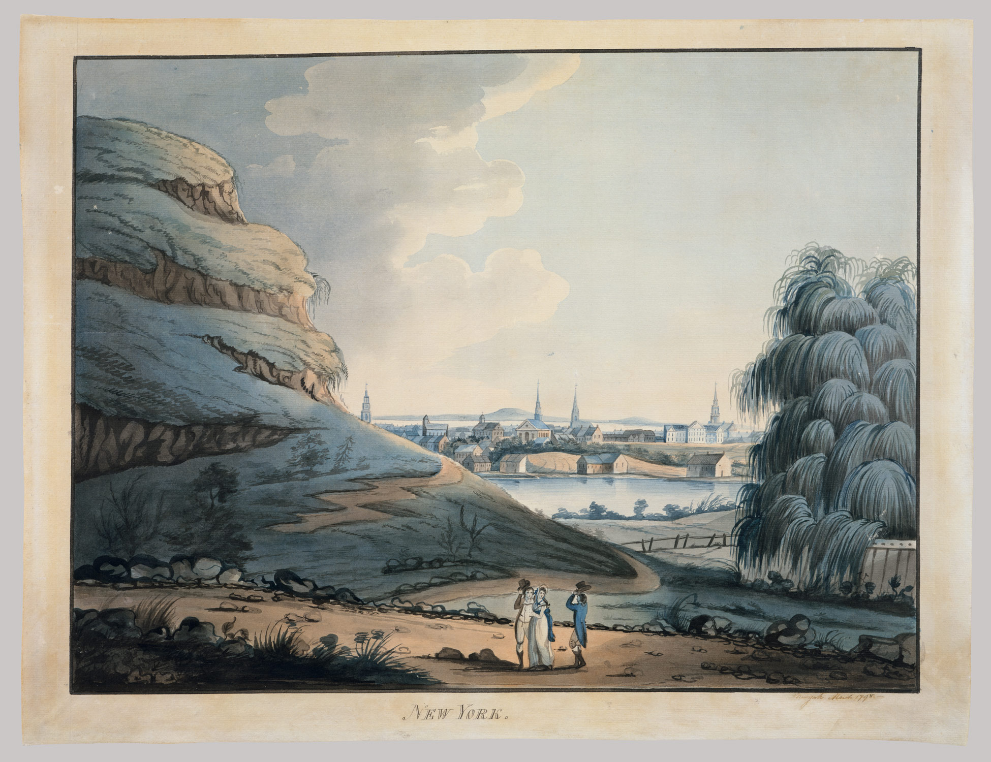
This lithograph was made just prior to the time Brandreth built his first factory building. The artist is standing on high land in the hamlet of Sing Sing, later to become the village of Ossining. The view is to the north west and Oliver Cromwell Field's property, where Brandreth will build, is out of sight, over the hill at center. The neck of land jutting into the Hudson is Croton Point. This part of the river is called Haverstraw Bay. The small peak pointed skyward on the horizon is High Tor, where Rip Van Winkle fell asleep.

{Caption: Sing-Sing or Mount Pleasant, lithograph by Jacques Gérard Milbert, Jacques, from: Itineraire pittoresque du fleuve Hudson et des parties laterales de l'Amerique du Nord, d'apres les dessins originaux pris sur les lieux. Source: NYPL Digital Gallery}

This painting shows Haverstraw Bay in 1839 with the artist standing in Sing Sing looking south and west. By this time Brandreth had built his first factory but it and the Field residence are out of sight to our right.

{The artist is W.H. Bartlett; source: rootsweb.ancestry.com}

This 1885 ad for the pills and the porous plasters shows Haverstraw Bay looking southwest from the river-side factory. The boy has one of the plasters on his back.

{source: wikipedia}

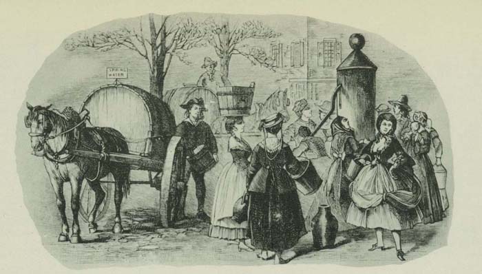
Here are some testimonial-style advertisements from the New York Tribune in 1871. Notice the willingness of officials to help promote what was then a place where many of the village's young women and not a few of its men found work.

{The Tribune almanac and political register edited by Horace Greeley (The Tribune Association, 1871)}

This detail from a property atlas shows the factory structures and residences as of 1893. H.C. Symonds was a member of the Brandreth clan. The house was labeled "Mrs. Brandreth" on earlier maps. I suspect that Miss J. Van Wyck was one as well. Her house was labeled "P.G. Van Wyck" on earlier maps. The original factory building is here labeled "Store House".

{Atlas: Sing Sing by Julius Bien & Co., 1893: source: David Rumsey Map Collection}

This larger view shows the growth of the village in the 60 years since Brandreth first moved there.


I haven't forgotten that it was the humane traps which first attracted my interest in the factory. This ad for it appeared in 1962.


As I say, Ossining is next door to the village where I was raised and I've consequently done some blog posts in which it figures. Here are some links: --------

Some sources:

“Eisenhower in War and Peace” by Jean Edward Smith a review by Jonathan Yardley, February 6, 2012

"Brandreth Pills" in Brother Jonathan: A weekly compend of belles lettres and the fine arts, standard literature, and general intelligence Horatio Hastings Weld, John Neal, George M. Snow, Edward Stephens (Wilson & Company, 1842)

Brandreth Pills in The Humbugs of the World, An Account of Humbugs, Delusions, Impositions, Quackeries, Deceits and Deceivers Generally, in All Ages, by P. T. Barnum (1866)

Ossining's Historic Brandreth Pill Factory, Ossining's Brandreth Pill factory gained its National Register designation in 1980 because of its connection with Dr. Benjamin Brandreth, by former Ossining Mayor Miguel Hernandez in Ossining Patch

Benjamin Brandreth on DaleCemetery.com

EPN Real Estate Services to complete Hidden Cove on the Hudson, New England Real Estate Journal, January 8, 2008, an article about proposed development of the property

Hidden Cove on the Hudson, documents related to proposed development of the property for upscale housing

Draft Environmental Impact Statement Hidden Cove on the Hudson (pdf), one of the documents

Archaeological Assessment Hidden Cove on the Hudson (pdf) another of the documents

When Sing Sing Was a 'Model' Prison March 19, 2009, in Postscripts, an online magazine offering a pastiche of articles on current affairs, history, technics, opinion, writing, advice, humor and trivia.

Purgation Unlimited James Harvey Young, in The Toadstool Millionaires: A Social History of Patent Medicines in America before Federal Regulation

Brandreth Pill Factory Documents, 1863-1900

The Tribune almanac and political register edited by Horace Greeley (The Tribune Association, 1871)

Archaeological Assessment and Field Investigation, Hidden Cove Development, Brandreth Pill Factory, Village Of Ossining, Westchester County, New York (pdf)

"A Most Mephitic Mystery" by venta Belgarum in The Sandisfield Times, Vol. 1, No. 5, August 2010

Brandreth's Pills in Historical Images of the Drug Market, Medical Collectors Association Newsletter, December 22, 2000


Allcock's Porous Plasters by Caroline Rance on October 16th, 2009

Œuvres complètes d'Alexis de Tocqueville (M. Lévy frères, 1865)

Fiberglass Adirondack Guideboat in Boats and Boating in the Adirondacks by Hallie E. Bond (Syracuse University Press, 1998)

Gen Fox Conner on findagrave.com

Thomas Allcock on findagrave.com

Benjamin Brandreth on wikipedia

Thomas Allcock on wikipedia

FUNERAL OF DR. BRANDRETH.; SING SIGN VILLAGE IN MOURNING--THE WHOLE POPULATION AT THE FUNERAL, New York Times, February 23, 1880

DEATH OF G.A. BRANDRETH.; Head of a Well-Known Manufacturing Company and Prominent in the Affairs of His Town, New York Times, November 16, 1897

BERNJAMIN BRANDRETH'S WILL.; HOW HE DISPOSED OF HIS PROPERTY AND BUSINESS, New York Times, February 26, 1880

Dr. Brandreth Symonds, New York Times, August 26, 1905

DEATH OF G.A. BRANDRETH.; Head of a Well-Known Manufacturing Company and Prominent in the Affairs of His Town, New York Times, November 16, 1897

Conner -- Brandreth, New York Times, June 5, 1902

Paid Notice: Deaths CONNER, FOX BRANDRETH, New York Times, July 19, 2000
Extract: "CONNER, FOX BRANDRETH - Fox Brandreth Conner of Ossining died on July 17, 2000, at the Arden Hill Nursing Home in Goshen, NY. He was 95. Mr. Conner was born June 23, 1905, at Fort Hamilton Army Base in Brooklyn, NY. He was the son of Major General Fox Conner, Chief of Operations for the American Expeditionary Forces in Europe during World War I, and Virginia Brandreth Conner. Mr. Conner married Muriel Macpherson in 1927. She died on September 12, 1986. ... In 1929, he joined the family business, the Allcock Manufacturing Company, in Ossining. ... In the 1930s, the company began producing Havahart traps, humane traps that capture animals alive and unhurt. Mr. Conner became President of the company in 1945 and began to focus exclusively on manufacturing Havahart traps, which became the country's most popular humane animal traps, sold in the United States and overseas. ... Mr. Conner was an avid fisherman and outdoor sportsman, spending much of his time at the family seasonal residence in the Adirondack Mountains at Brandreth Park, NY. He enjoyed gardening and reading, and was an accomplished wood sculptor. ... "

Brandreth Pill Factory
Extract: "During the later years of the 19th century and the early 20th, the factory began to diversify its operations in response to increasing federal regulation of the patent-medicine industry. Among the new products were ammunition-box liners for the military during World War I. ... Franklin Brandreth stepped down in 1928 and was replaced by his grandson Fox Brandreth Conner. By then the domestic market for the pills it had once manufactured in abundance was gone. ...In 1940 the company sold the buildings at the southern end of the property to the Gallowhur corporation, which used them to make insect repellent and suntan lotion. The rights to the pill formula were also sold off after World War II. Brandreth's company, under the Allcock name, continued its manufacturing operations in the 1870s complex until 1979. They were later used by the Filex Corporation, a maker of steel office furniture."

------

Notes:

[1] Jaime Martorano and Abandoned New York have made available excellent, though fiercely protected, photo sets of the factory complex.

[2] Here is the full certificate.

{source: hudsonriver.westchesterarchives.com}

[3] Notice that one local resident bears the name Conner: "Jas. Conner" lives in a house on Snowden Ave. (top right of image). I don't know anything about the man but there may be a connection with the Conner family which eventually took over management of the Brandreth factory. It's also interesting to see a member of the Van Wyck family on the Brandeth property. The house of "P.G. Van Vyk" at Grove Hill is just east of the office and store house and somewhat north of Mrs. Brandreth's residence.

[4] Notice that there is a Van Wyck St. pointing south west toward the Van Wyck property. An atlas of 1893 shows "Miss J. Van Wyck" to be owner of this place. It also shows that the house of Mrs. Brandreth then belonged to a "H.C. Symonds". Symonds was a member of the Brandreth family.

[5] Alexis de Tocqueville once visited Oliver Cromwell Field at his home in Sing Sing: "Singsing, 31 mai 1831. Il y a à Singsing un vieillard qui se rappelle avoir vu les Indiens établis dans 'ce lieu. Le nom même de Singsing est tiré du nom d'un chef indien. On nous montre une maison où demeure un descendant d'Olivier Cromwell."

Sunday, May 01, 2011

The Old Leather Man (again)

This photo shows the Old Leather Man seated outside a house in Middlefield, Connecticut. It was taken sometime between 1869 and 1889.


{Caption: The Leather Man sits to eat in Middlefield in this undated photo. Researchers are planning to dig up the Leather Man's grave next year in an attempt to determine his identity. Source: The Republican-American newspaper of Waterbury, CT[1]}

About a year ago I wrote a post about him.[2] Since then a controversy has arisen over plans to exhume his remains, perform some scientific tests, and rebury them in a new location. Last December a writer named Phil Reisman gave a succinct account of these plans on the LoHud news blog — Exhuming the Old Leatherman. The comments section of this post contains the beginnings of a debate between those who support and who oppose the project. During the past couple of months local reporters have picked up on the story and comments lists have grown. See for example see Briarcliff’s Mysterious and Legendary Leatherman by Kathleen Reilly on the Pleasantville-Briarcliff Manor, NY, Patch network blog, The Footsteps of the Leatherman by Mike Paoletto on the Trumbull, CT, Patch network blog, and Digging up the Leather Man's story in Conn., an Associated Press report.

The Ossining Historical Society owns the cemetery but its web pages contain nothing on the subject.[4] A set of pages called Leave the Leatherman Alone are distinctly polemical but nonetheless full of interesting details, including a copy of the OHS petition to the NY supreme court system and other court documents. The petition says the OHS Museum would like to remove the body, conduct "forensic and genetic testing" for purposes of "public education on historical and genealogical matters," and rebury of remains in another part of the cemetery. The "Leave the Leatherman Alone" site currently has a polite Letter To The Ossining Historical Society as its top posting. Along with most people who have spoken out on the subject, the writer of the letter, Don Johnson, says that it would be better not to exhume the remains at all, but if they are to be relocated, there should be no tampering with them. The Leather Man wanted privacy during his life and there is no good reason to subject his body to invasive study now or ever.

Newsmen Steve Frank, Ray Bendici, and others connected with a site called Damned Connecticut have followed the controversy and prepared a series of useful blog posts about it, including an Interview with Don Johnson and some helpful photos. The photos include this one, which shows the current location of the grave and its marker. As you can see, a cemetery access road currently runs over part of the grave. The road that passes close by is a busy one which is, reportedly, to be widened at some future date. These, plus the quantity of visitors to the grave (including --- by OHS permission -- geocachers), and the fact that the current location is in a "paupers'" area, are the reasons given for moving the remains to another location in the cemetery.

{source: Damned Connecticut[4]}

A few days ago a man named Stephen Griswold alerted me to the OHS plans and the concerns that many are raising about them. He summarized the objections that have been submitted and raised some questions about OHS motives. He asked why, for example, the OHS wants to exhume and rebury these remains and not others that are to be affected by road-widening. He also said the person who runs the OHS Facebook page has been deleting comments that raise questions about the project or show opposition to it. (Note that the FB page does now have comments from April 11 and 12 which are critical of the OHS plans.)

----------

Some recent sources:

Leather Man, century-old hermit, to be exhumed David Pescovitz on BoingBoing Friday, Mar 4, 2011

Leatherman Series on Geocaching.com

Who was the Leather Man? Experts hope forensic tests will solve mystery by Sam Cooper, Republican-American, Waterbury, CT, November 29, 2010,
-----------

A few of many (many) accounts in 19th- and 20th-century newspapers:

Story of the Leather Man, by Fred C. Warner, Putnam County Courier, Carmel, NY, Jan. 19, 1961

'Old Leather Man' Still Remains Enigma by Ray Barnett, The Herald Statesman, Yonkers, NY, March 5, 1937; subhead: Newspaper Clippings and Photograph Owned by Mt. Vernon Woman Prove His Existence, But Search by Historians Fail to Reveal Identity

Is It The Same Leather Man?; A Silent and Patched Wanderer who Carries an English Bible and is Never Ill, The Sun, November 12, 1883

The Old Leather Man Arrested, The Recorder, Mt. Kisco, NY, December 7, 1888. Excerpt: "Chief of Police Chapman of Middletown, Conn., new New Haven, arrested the "Old Leather Man" last Friday and put him in the insane asylum. He escaped on Sunday, however, and stated for New Haven. He was last seen going toward a cave which h has frequented, between Middletown and Higganum. Only last week he passed through New Castle Corners, on his usual trip east."

THE OLD "LEATHER MAN" DEAD, New York Times, March 25, 1889. Excerpt: "The queer old hermit who has been known throughout this State for some years as the "Leather Man," from his unique apparel. Which was made of skins, was found dead in his cave on the George Dell farm in Mount Pleasant, near Sing Sing, yesterday."

HIS LIFE A PENANCE.; THE STRANGE STORY OF THE FAMOUS VAGRANT, THE LEATHER MAN, New York Times, March 26, 1889.

Here is a copy of this NYT article.


This satellite image shows the location of Sparta Cemetery. The Old Leather Man's grave is in the south-east quadrant, invisible beneath the leafed-out trees.


View Larger Map

-------

Addendum:

I prepared my original Leather Man post as part of series on the old Croton Aqueduct, which runs close by Sparta Cemetery. To see these posts, click the tag "Croton Aqueduct" in the list headed "Labels" at right. I'd begun looking into the aqueduct while tracking some family history. One of my great-uncles worked for the engineering firm that contracted to build it. Also, I'd been exploring some family-history connections in the Five Points neighborhood. That had been the site of a lake that previously supplied a lot of New York's water and it was near the terminus of the Aqueduct in New York's City Hall Park. Click the tags "family history" and "Five Points" to see these posts.

--------

Notes:

[1] Rep-Am copyrights its pages, but the photo is 19th century and thus presuably in the public domain; at any rate I'm reproducing it under fair use provisions of copyright law with linkback to the source page.

[2] He was generally called the Old Leather Man during the 19th- and 20th-centuries. For the most part he's been called simply Leatherman since then.

[3] There's also an Ossining Historical Society page on Facebook. The OHS person who moderates that page has replied to a couple of recent comments requesting that OHS not carry out forensic testing. The first says that the information given on the headstone is inaccurate and needs to be corrected (there is no disagreement about this) and the second says "To tell you the truth, since he was buried in a paupers style grave (we still have the receipt) there may not be anything left to dig up but the earth itself." However, in response to an earlier question, the OHS person seems to be much more optimistic about examining the remains: "We are very excited to have Dr. Nicholas Bellantoni, State Archaeologist with the Connecticut State Museum of Natural History and Archaeology Center at the University of Connecticut. Stay tuned for more info."

[4] I'm reproducing this copyrighted photo under fair use provisions of copyright law with linkback to the source page.

Wednesday, September 01, 2010

Broadway in the '30s

The print shows a section of Broadway in 1836. It's an etching made from a drawing by an English artist and land surveyor, Thomas Hornor, and it's remarkable for its accurate detail and something akin to photographic realism.[1] Our viewpoint is a position on Broadway just south of its intersection with Canal Street. We are looking north and can clearly see the block between Canal and Grand Street but beyond that point it's increasingly difficult to make things out.

{Caption: Broadway, New-York. Shewing each Building from the Hygeian Depot corner of Canal Street, to beyond Niblo's Garden. Etched by T. Hornor. Printed by W. Neale. 17% x 27. Published in New York by Joseph Stanley and Co. Source: Library of Congress}

Here are some detail views of this interesting cityscape.

1. Broadway above Canal in 1836 had trees. Most look to be poplars. Its a shopping district and there are apartments above the shops. In one of these a woman, apparently with babe in arms, looks out at the passing scene. The sidewalks are crowded with people who seem to be well-dressed and — many of them — better than modestly prosperous. Dogs run loose while horses are kept carefully under control.


2. We are at the dawn of the age of electric traction and the first electric streetcar was already running on nearby Fourth Avenue. Here on Broadway, however, horses are the only means of transport, so much so that they are almost as abundant as people. Pedestrians occupy the streets as well as the sidewalks. There is a high pole with foot pegs for climbing and a Phrygian cap on top.[2] It must be a Liberty pole. There was one of these poles nearby at City Hall Park and evidently here at Broadway and Grand as well.[3] Note the presence of "Tattersalls" mid-block. Broadway House looks like a hotel but was considered to be an inn or tavern at the time. It was known for hosting political meetings.[4]


3. Joseph Stanley published this etching and he was not shy to have Hornor put his establishment front and center.[5] The uprights with cross-pieces were evidently used to display goods for sale, though no goods are here present. Note the cigar store. Two of my German-immigrant relatives were in the "segar" selling business in these years, though the shops they operated were in Washington Street a few blocks away. Nearby, Cornelius McLean runs a business making fanlights and window sashes.[6] The Bank Coffee House started out south of this location, in the rear of the Bank of New York at William and Pine Streets. I don't know when it moved here. "Coffee house" in this instance is a euphemism for tavern. The place was known as a merchants' gathering place.[7] The wagon carrying "Spring Water" is a reminder that the Croton Aqueduct has yet to be constructed.[8]


4. In these times people gathered at windows to catch light for reading or sewing, as do these ladies. The sign at 416 announces a trunk maker, but a book published in 1833 records a boot and shoe manufactury run by C.B. and J.C. Greene at this location.[9] In 1850, the owner's name was Adolphus Loss.[10] Mr. Wright, also at 416, sells, caps, and furs. [11]


5. Located at Stanley's shop at 50 Canal Street, the "General Depot for the Sale of Morison's Hygeian Medicine" sold the "Vegetable Universal Pills" of James Morison, a British entrepreneur who had announced that everyone could maintain his own health without the services of "elitistic" physicians. The plants in the windows proclaim the virtues of medicines based on natural plant products.[12] Analysis of the secret-formula pills showed that they were no more than laxatives. Signs proclaim the bookseller, Stanley, to be the American agent for sale of all London editions and of English editions of London and American writers. Here, in the 1830s, English authors seem to outrank the home-grown variety. In this view as in others, it's apparent that this part of Broadway was the fashionable shopping district of the 1830s.


6. There are horse-drawn omnibuses and hired coaches as well as private carriages. This was a period when men still rode horses in the city merely to get from one place to another. In a short while the cost and inconvenience of this form of transportation would eliminate it from common use.


7. Here we have one of the omnibuses, grandly pulled by four matched horses. The driver is assisted by a groom. Everyone rides inside. The British mail-style coach with roof-top seating would come later.[13] If it hasn't been plain before, it certainly is now clear to us that anarchy reigns on this part of Broadway. There's no lane discipline nor any sense that vehicles in motion take precedence over bodies at rest.[14] There are three large beams rising at angles on the sidewalk, but what they are I cannot say.


8. More public transport, more dogs, more pedestrians strolling street and sidewalk. There are many women out and about, most of them unescorted by men. There's only one cab-like vehicle that I can see. The hansom cab was invented in England in 1834 and only later introduced into the traffic of New York City. At the time our drawing was made people would hire much less maneuverable and more expensive Hackney Coaches to get around in.


9. Street-sellers outside the trunk and hat shops. You can buy wood to burn, potted flowers and notions, boots and curtain stuff. Note that the woodseller will cut to order.


10. Ice was a summer luxury. It would be harvested from ice ponds in winter and kept in sawdust-filled warehouses as long as possible through the warm months.


11. Lockwood's was a bookseller, here advertising as a school book depository. A memoirist of 1893 remembers the "famous book-store of Roe Lockwood, on Broadway, below Lispenard Street, where all the boys of forty years ago went to purchase their school-books."[15] I think the wig maker was John Hotblack, "wig and ornamental hair manufacturer, wholesale and retail, 415 Broadway."[16] One of the dogs has a dead bird in its mouth; two others look ready to fight over it. No one nearby pays any attention to the three. Street sellers on this side of Broadway offer potatoes and other foodstuffs that can't be identified.


12. Here's the title of the print. Niblo's Garden was operated by John Niblo at 557 Broadway, then only a couple of years old. It was a public garden and theater.[17] Back then, the suburbs began not far north of its location.


Here's a copy of the print with aquatint in lower resolution.


{Hand-colored etching aquatinted by J. Hill, 1838; source: "unforth Claire H." on flickr -- About unforth / Claire H.}

She also gives these detail views.


An old book has yet another version.


{Broadway and Canal in 1836 from Valentine's manual of old New York, Volume 12, edited by Henry Collins Brown (Valentine's manual, inc., 1917)}

-----------

Some sources:

Niblo's Garden, in The New York clipper annual (1892) at Columbia University Libraries
(New York : Frank Queen Pub. Co., 1883-)

Thomas Hornor: Pictural Land Surveyor, by Ralph Hyde; Source: Imago Mundi, Vol. 29 (1977), pp. 23-34. Published by: Imago Mundi, Ltd. Stable URL: http://www.jstor.org/

The iconography of Manhattan Island 1498-1909 (v. 6) by I. N. Phelps Stokes
(New York, Robert H. Dodd, 1915-1928)

The New York mercantile union business directory (S. French, L.C. & H.L. Pratt, 1850).

Bowery Village, The diary of Michael Floy, Jr., Bowery village, 1833-1837, by M Floy; Richard Albert Edward Brooks; Margaret Floy Washburn (New Haven, Yale University Press, 1941)

Valentine's manual of old New York, Volume 12, edited by Henry Collins Brown (Valentine's manual, inc., 1917)

----------------

Notes:

[1] Photography had been invented at the time Hornor made this drawing, but no photograph of the time could match the fine detail he produced.

[2] To Americans of the time, the Phrygian cap symbolized liberty achieved by revolution. It was the bonnet rouge of the Parisian sans-culottes and Marianne, the national symbol of France, is normally shown wearing one.

[3] There was definitely one at this intersection in 1856 &mdash see Liberty Pole on barrypopik.com. However, this drawing made in 1852 shows the pole sporting an American flag, still surmounted by windvane but lacking the cap.

{Broadway looking north at Grand St., engraved on copper for the Society of Iconophiles of New York, by Walter M. Aikman 1905 from a painting by R. Bond 1852. Source: NYPL Digital Gallery}

[4] Tattersall's is easy to make out in this drawing. Broadway House is the large building on the corner to the left.

{Broadway between Howard and Grand Streets, in 1840. 17 x 24.8 cm. Cutting from Munsey's magazine. Source: NYPL Digital Gallery}

Regarding Broadway House, see The iconography of Manhattan Island 1498-1909 (v. 6) by I. N. Phelps Stokes
(New York, Robert H. Dodd, 1915-1928) and Historic Lower Broadway, Relics of the Past Becoming Scarce in That Section, but a Few Remain to Recall the Men and Events of Importance in Days Gone By. New York Times, May 24, 1903, Sunday, Page 33.

[5] As well as publishing books and prints, J. Stanley & Co. ran the Franklin Circulating Library and Reading Room. This ad appears in New York As It Is (1833).


[6] See New-York as it is: containing a general description of the City of New-York; list of officers, public institutions, and other useful information: including the public officers, &c. of the City of Brooklyn : with additions and corrections : accompanied by a correct map by Edwin Williams (T.R. Tanner, 1833)

[7] See History Of Coffee in Old New York.

[8] I've written a number of blog posts about the aqueduct. One of them discusses "tea water," a term, like "spring water," which merchants used to convey the notions of purity and fresh taste. [9] Trow's New York city directory (J. F. Trow., 1860)

[10] New-York as it is: containing a general description of the City of New-York; list of officers, public institutions, and other useful information: including the public officers, &c. of the City of Brooklyn : with additions and corrections : accompanied by a correct map by Edwin Williams (T.R. Tanner, 1833)

[11] For Adolphus Loss: The New York mercantile union business directory (S. French, L.C. & H.L. Pratt, 1850).

[12] See The Nineteenth Century — The Beginnings of Modern Medicine by Albert S. Lyons>. Here is a page from New-York as it is of 1833:


[13] I've done a series of blog posts on these horse-drawn omnibuses: [14] In fact the practice of marking lanes and enforcing lane discipline did not evolve until the 20th century. See the wikipedia article on lanes for more on this.

[15] The quote comes from Bowery Village, The diary of Michael Floy, Jr., Bowery village, 1833-1837, by M Floy; Richard Albert Edward Brooks; Margaret Floy Washburn (New Haven, Yale University Press, 1941). See also The New York mercantile union business directory) (S. French, L.C. & H.L. Pratt, 1850)

[16] Wigs New-York as it is (1833).

[17] New-York As It Is (1833) carried this ad for Niblo's:


And see (The New York mercantile union business directory). And see also Niblo's Garden, The New York clipper annual, 1892(New York, Frank Queen Pub. Co., 1883-)

Wednesday, June 02, 2010

Collect Pond and the origins of Five Points

This blog post is second in a series on the history of an area of New York City called Five Points. It's part of a larger series on New York's Mulberry Street and its residents.[1]

Five Points came into existence after a canal was cut along a meandering creek to drain a body of water called Collect Pond. This drawing somewhat fancifully shows the appealing nature of this little lake in 1798. The artist was standing about where Mulberry Street would later be laid down.[2]


{Collect Pond, New York City, 1798 Attributed to Archibald Robertson. Watercolor and black chalk on off-white laid paper, 17 3/4 x 23 1/16 in. From the Met Museum's Edward W. C. Arnold Collection of New York Prints, Maps, and Pictures}

This lithograph shows the pond as it looked in 1796. I think the artist is standing on the east side looking west.


{Engraved by Philip Meeder ca. 1836 for a book called History of the city of New York: its origin, rise and progress. (New York, Barnes, 1877-1896.) via wikipedia}

This print from the early nineteenth century shows locals at one of the pumps that tapped the spring which fed Collect Pond.


{From the same book; source: virtualny.cuny.edu}

As the source of the print explains, this pump dispensed tea-water not in the sense that it was brown and brackish, but rather that it was clear, sweet-tasting, and suitable for use in brewing expensive Indian tea.

This shows a more famous tea-water pump, located to the southeast of the pond.


{"The Tea Water Pump at Roosevelt and Chatham Streets, one of the city's principal fountains." Source: virtualny.cuny.edu}

This map of lower Manhattan in 1803 shows the location of the Collect Pond, Mulberry St., Tea-Water Pump, and Pump St. Knapp's Pump is off map to the north and west. Pump Street was named to commemorate Teawater Pump and adjacent Teawater Gardens.[3]


{Source: urbanography.com}

You'd think Collect Pond got its name from its job of collecting water from the spring that fed both it and the nearby pumps. Not so; collect is a corruption of the Dutch word kolk meaning a small body of water. Kolk morphed into kolch and then kalch before getting Englished to collect. This map gives the old name.


{source: nymapsociety.org}

You can see from this map that the spring-fed pond emptied by rivulets both east and west across the island. In fact, one source says before the arrival of Europeans the indigenous Native Americans could — during the spring floods — paddle from the East River to the Hudson River through the Collect Pond.[4]

The steamboat in the print by Philip Meeder that I reproduced above shows the first successful experiment in the US to build a working steamboat. In the summer of 1796, the designer, John Fitch, selected Collect Pond as the place to show off his achievement. As the world knows, it was Robert Fulton who eventually produced the first commercially successful steamboat, launching it in the nearby Hudson.[5]

By the time Fitch conducted his test the pond was making a transition from the bucolic spot shown in Robertson's and Meeder's pictures and was being inundated with noxiousness: slaughterhouses, tanneries, gunpowder storage facilities, seasonally-flooded bogs, and prisons. As early as 1798, the year of Robertson's watercolor, it was described as "a shocking hole, where all impure things centre together and engender the worst of unwholesome productions."[6]

A few years later, in an action of urban cleansing, the pond was drained and filled in to make room for more buildings in which to house the city's growing population. A canal was dug along the stream that fed from the pond to the Hudson on its west and a new road, Canal Street, was constructed by its banks.

This 1811 lithograph shows the drainage canal as it passes under a bridge at Broadway. Canal Street runs on both sides of the water.


After the canal drained off most of the water, "Bunker Hill," the little hill in Robertson's watercolor, was leveled and its mass used to fill the wetlands that remained. By 1813 there were no visible remains of pond or hill.[7]

A nineteenth-century historian explains the city's next actions:
At the spring election of 1835 a most serious question was submitted to the decision of the people. New-York had never enjoyed any proper and reasonably assured water-supply for a population of her extent and promise. The tea-water works, which were put up in 1786 at the Collect pond, or Fresh Water, had supplied the city by casks until 1799, when the Manhattan Company was chartered to bring a supply from the Bronx River. A pump was built near the Collect and wooden pipes laid through the streets, but the Manhattan Company never tapped the waters of the Bronx, and the city was forced to content itself with the old Collect supply. ... It was now decided by popular vote, by a large majority, to construct an aqueduct from the Croton River, an undertaking of great magnitude in those days, considering that the distance the water had to be conveyed was forty miles.
-- The Memorial History of the City of New-York: From Its First Settlement to the Year 1892, Vol. 3, ed. by James Grant Wilson (New York History Co., 1893)
I've written previously about Croton Aqueduct and some of its many associations.[8]

The aqueduct, which was the greatest engineering feat yet attempted in the US, proved to be a great success. New Yorkers celebrated extravagantly when its waters first flowed in for their use. To show how great was the achievement and how abundant the water, the city set up fountains, including this one, just south of the place where Collect Pond and the Chatham Street Tea-Water Pump had been located.


{View of the Park Fountain & City Hall N.Y., N. Currier, 1846; source: nymapsociety.org}

Despite drainage and in-filling, the area around Collect Pond remained marshy, mosquito-ridden, and unwholesome. Being unhealthy, the land was cheap. Being infirm, it could not support multi-storied brick buildings, but only small brick or wooden frame structures. The resulting cheapness of land and its dwellings meant that the area became a magnet for the city's poorest citizens, those who could afford no other place to live. Out of this mix, the slum called Five Points was born.

This lithograph depicts the center of the slum, in Five Points intersection itself, just 14 years after the pond was covered over.


{Five Points by George Catlin, 1827; source: Maulleigh flickr page}

As you can see from this detail, there was then a pump drawing water from the spring that still flowed under feet of the area's residents.


Some additional sources:

Collect Pond on wikipedia

Collect Pond, Manhattan from the New York Public Library

The Documentary history of the state of New-York The Documentary history of the state of New-York: arranged under direction of the Hon. Christopher Morgan, secretary of State, Volume 2, ed. by Edmund Bailey O'Callaghan (Weed, Parsons & co., public printers, 1849)

Collect Pond on the New York Parks web site

Canal Street on forgottenny.com

THE FIVE POINTS on urbanography.com

Evolution of City Hall Park and Foley Square from nymapsociety.org

1850 US Census of the New York City Prison AKA The Tombs on rootsweb.ancestry.com

Harper's magazine, Vol. 98, 1899, "A Historic Institution. The Manhattan Company — 1799-18989" by John Kendrick Bangs (Harper's Magazine Co., 1899)

Collect Pond in New York City Map and Steamship Test Print, 1846 on georgeglazer.com

The Life of John Fitch the Inventor of the Steamboat by Thompson Westcott (Philadelphia: J. B. Lippincott & Co., 1857)

-------------

Notes:

[1] Here are the blog posts on Mulberry Street so far:
Mulberry Street 1900
Mulberry Street, again
a tenement on Mulberry Street
five-cent den on Pearl St.
[2] A curator at the Metropolitan Museum of Art writes of this picture: "The natural pool Collect Pond was located in lower Manhattan near present-day Foley Square. This watercolor of the site exemplifies the formulaic method of drawing taught at the Columbian Academy of Painting in New York City, founded by the brothers Archibald and Alexander Robertson. Both the hill at left and the willow tree at right were rendered in highly stylized fashion, with broad contours and schematic curving lines. Spatial depth was achieved with swaths of dark wash in the foreground, setting off the lighter forms in the distance. Indeed, the whole picture observes a kind of artistic etiquette embodied in the polite company of figures in the foreground."

[3] This map shows the pond in 1793 overlayed by 19th-c. streets.

{source: nymapsociety.org}


[4] In a web page called Evolution of City Hall Park and Foley Square, Philip Ernest Schoenberg, writes:
For hundreds of years, the area had been the site of an Indian village. ... The Indians were part of the Leni Lenape, Algonquin, or Delaware people. The population on the site may have been between 5,000 and 10,000. The total Leni Lenape population of Manhattan Island may have been as high as 30,000 and the New York metropolitan area may have been 65,000. Diseases reduced the native population of the area to 200 by the year 1700.

The village was known as “Werpoes” or “Hare” in the language of the Algonquin Indians. They were semi-nomadic. The village would move each planting season as the Indians burned the woods to gain new land to farm and let old land recover. The Leni Lenape planted the “Three Sisters” — squash, corn, and beans. They would also go to Washington Heights and Inwood neighborhoods of Manhattan to hunt deer and other animals. ...

In the Dutch period, the area was set aside as a Commons where anyone could graze a cow or sheep for free. It also became the ceremonial area for parades, celebrations, executions, and public gatherings. ...

In the British period, the area that had been center of the Indian village became the African Burial Ground. The blacks, slave and free, segregated in life, were segregated in death and were not permitted to be buried in the churchyards. By the end of the eighteenth century, the area was forgotten as residential development moved northward. An estimated 15,000 to 20,000 Africans and African-Americans were buried between today's Chambers and Reade Streets, Broadway and Centre Streets.
[4] Wikipedia's article on John Fitch says he "was an American inventor, clockmaker, and silversmith who, in 1787, built the first recorded steam-powered boat in the United States." Two decades later, Robert Fulton was able to make steamboats profitable. This broadside celebrates Fitch's achievement.

{Title: Honor to Whom Honor is Due" Origin of Steam Navigation. A View of Collect Pond and Its Vicinity in the City of New York in 1793"}
Description: An extremely scarce 1846 broadside issued by John Hutchings to promote the awareness of John Fitch as a pioneer of steam navigation. Fitch was an instrument maker working in the later part of the 18th century. As an early pioneer of steam navigation, Fitch tested several steamboats on the Delaware River between 1785 and 1788. One of these, the Perseverance, is depicted in the upper right quadrant of this sheet. Fitch’s real success, however, occurred a few years later when, in 1793 he tested another ship equipped with a paddle wheel on New York’s Collect Pond. This was a full six years before Fulton and Livingston launched “Fulton’s Folly” on the Seine. Hutchings claims to have been a “lad” at the time who “assisted Mr. Fitch in steering the boat”. Hutchings asserts that it was in fact Fitch who designed the steam propulsion mechanism. He claims that both Fulton and Livingston were present during the Collect Pond tests and in fact depicts both, as well as Fitch and himself, in a paddlewheel steam ship in the upper left quadrant. Though Fulton seems to have received most of the credit for the era of steam navigation, Hutchings hoped, through the publication of this broadside, to shed some light on Fitch’s contributions as well. Central to this publication is a map of the Collect Pond and vicinity extending roughly from Broadway westward to Chatam Street, south as far as City Hall Park and north to Canal. Roughly between Barlet Street and Franklin rested the Collect Pond, a natural depression and drainage area that filled with water seasonally. The Collect Pond appears in early maps of New York City and until the construction of the Croton Aqueduct was one of the few sources of fresh water in lower Manhattan. This pond was filled in around 1811 when it transformed into the notorious and poverty stricken "Five Points" district. When Fitch tested his steamboat the pond would have been surrounded by slaughterhouses, tanneries, gunpowder storage, bogs and prisons – not exactly a pretty place for an afternoon boat ride. The map image is surrounded by a brief biography of Fitch, signed attestations from important figures regarding the character of Fitch and Hutchings, and eye-witness accounts of the events in question. Right of the map is a description, written by Hutchings, describing the event and the Collect Pond vessel itself. Dated and copyrighted: “Entered according to act of Congress in the year 1846 by John Hutchings in the Clerk’s Office of the District Court of the Southern District of N.Y.” Date: 1846
References: "Collect Pond, Manhattan." New York Public Library: American Shores, Maps of the Mid Atlantic Region to 1850. 2002, http://www.nypl.org/research/midatlantic/geo_collect.html. Peters, Harry T., AMERICA ON STONE / THE OTHER PRINTMAKERS TO THE AMERICAN PEOPLE, p. 282
1846 Broadside of the Collect Pond, New York and Steam Boat ( Five Points )
[6] Quoted in: The Memorial History of the City of New-York: From Its First Settlement to the Year 1892, Vol. 3, ed. by James Grant Wilson (New York History Co., 1893)

[7] See the additional sources above, particularly: The Memorial History of the City of New-York: From Its First Settlement to the Year 1892, Vol. 3, ed. by James Grant Wilson (New York History Co., 1893)

[8] Here's a list of the posts: